
Newark ZIP Code Coverage
Only one Newark postal ZIP is verified in the research record. The normal postal ZIP is 94560, and the source set does not verify a second Newark ZIP, a Newark-specific unique ZIP, a PO-box-only ZIP, or a documented split or realignment. Nearby cities do not become Newark entries simply because a route or city label is close. Keep that boundary firm when building a postal directory.
| ZIP | Areas Covered | Post Office | Notes |
|---|---|---|---|
| 94560 | Newark city and local delivery area | Newark Post Office, 6655 Clark Avenue, Newark CA 94560-9998 | Principal verified Newark ZIP; no second Newark ZIP verified |
The listed post office phone is 510-797-0903. Retail hours in the research are Monday through Friday 8:30 to 5 and Saturday 10 to 2. Postal coverage is a delivery fact, not a statement that every address carrying the label lies inside the municipal line.
The official Newark Post Office listing is the source used to check the station details, while the USPS ZIP verification entry point helps confirm the code before an address search.
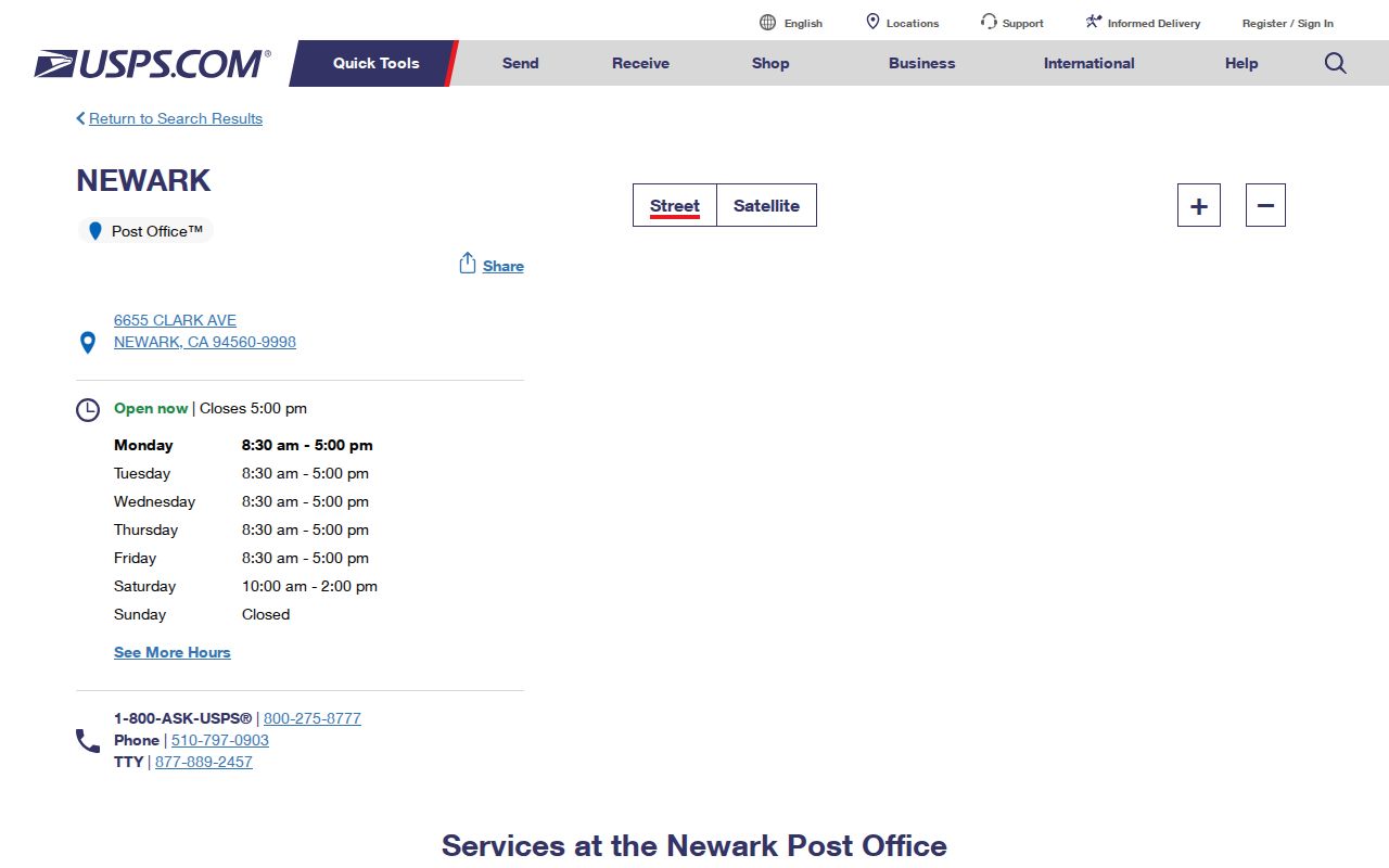
The listing ties 94560 to the Newark station without implying that a ZIP-wide resident roll exists.
Verify a Newark ZIP Code
USPS is the first stop for an exact-address check. Its tools accept a full street, city, and state entry, or a city and state search. Use the result to confirm the postal label before asking a county portal to interpret the address. A city and state result can show what ZIP serves the place name, while a full address result is the stronger check for a particular parcel or unit.
The USPS city and state lookup shows the postal search route.
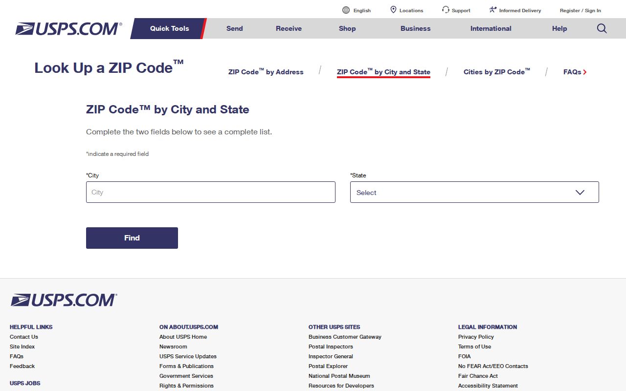
Use the USPS result as a delivery clue, then move to civic and property sources for jurisdiction and parcel facts.
- Enter the full street address, city, and state when checking one Newark location; keep the unit or suite detail in your notes.
- Run a city and state check only as a broader comparison, not as proof that every result belongs to Newark's city line.
- Save the returned ZIP and preferred place wording exactly, because county systems may normalize the city label in a different way.
- Compare the postal result with the Alameda GIS boundary and the Assessor situs address before making a parcel claim.
- Use a name or address record only after the postal and civic layers agree on the location being studied.
Newark Portal Limits
A ZIP code does not turn the Alameda property, GIS, voter, or permit portals into a people browser. Each system keys to a different object. The Assessor primarily uses APN and site address. GIS uses a parcel polygon and mapped layers. The Recorder uses a party index and instrument details. Voter status authenticates one voter. Newark eTRAKiT can show an address or ZIP on a permit result, but its public guide does not promise a ZIP-only search.
| USPS | Confirms a delivery label from a full address or city and state; it does not list residents. |
|---|---|
| Assessor | Uses APN or situs address for parcel information; owner-name internet access is restricted. |
| GIS | Maps parcel shape, jurisdiction, and layers; a postal ZIP filter was not confirmed. |
| Recorder | Finds named parties and instruments; it is party-indexed, with 1969-present electronic indexing and older microfilm. |
| Voter profile | Authenticates the voter; it is not a ZIP browse or open name directory. |
| eTRAKiT | Public permit search can use address or APN; registration is required for applications and inspection scheduling. |
Those limits are useful. A parcel search can support a legal location, but it cannot fill in every household member. A ZIP directory built from guessed portal behavior would blur postal, property, and personal records.
Newark ZIP Code Directory Scale
Newark covers 13.92 land square miles, and the 2020 Census counted 47,529 residents. Those figures describe the municipal geography and population, not a postal list. They help explain why a ZIP search can feel broad even when one city has a compact land area. The Census profile is a geographic reference that should be read beside USPS and county maps.
The Census QuickFacts Newark profile supplies the official city scale used here.
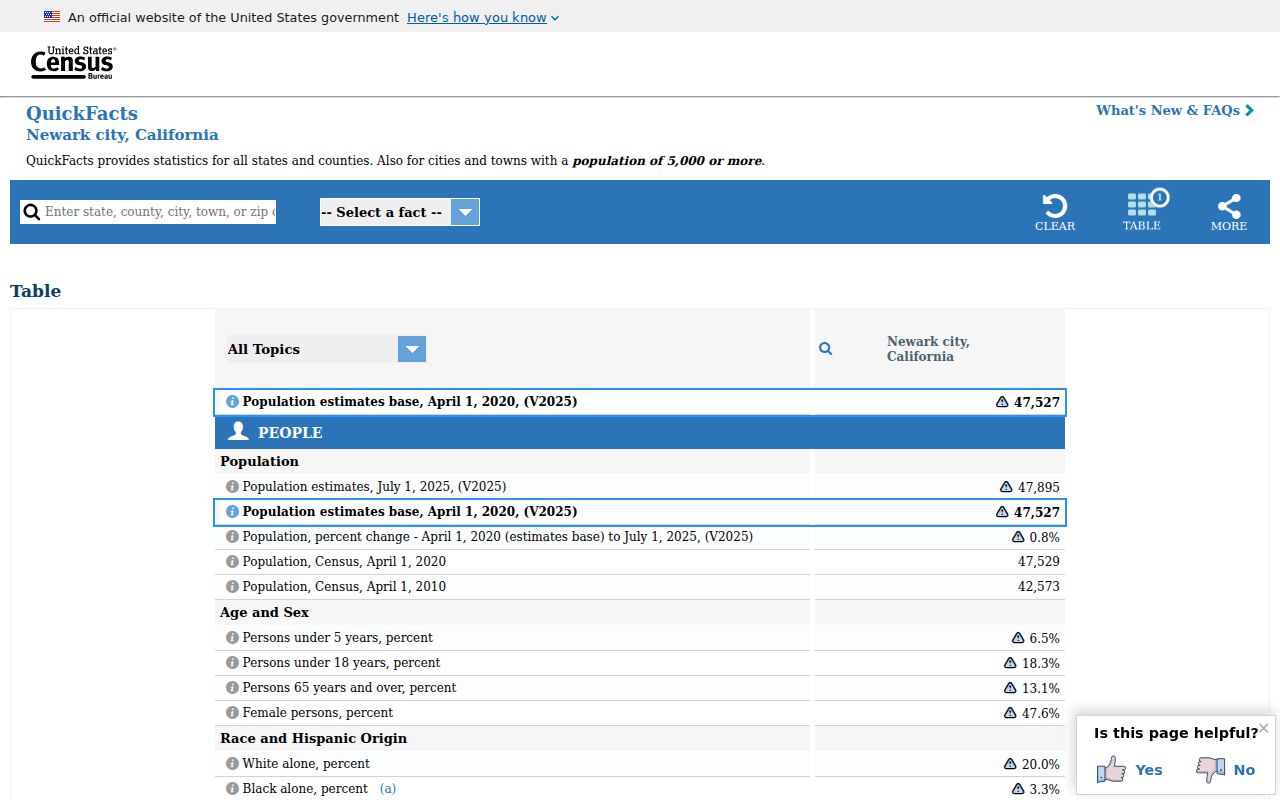
The profile gives the city context while leaving postal verification to USPS and parcel verification to county systems.
Newark Postal and City Lines
ZIP Codes are delivery routes, not municipal borders. A mailing address with Newark in its city line does not by itself prove that the parcel sits within Newark. Conversely, an agency database may normalize a city label differently from USPS preferred place naming. Check the mapped city boundary in Alameda GIS, then check the Assessor situs and the Recorder legal description for the parcel question.
Newark is bordered largely by Fremont and the Bay or wetlands. That setting makes place-name drift easy to miss. A researcher should not add a Fremont ZIP to a Newark table merely because the cities touch, and should not infer city jurisdiction from a postal label alone.
Postal versus civic. USPS answers where mail is routed. GIS answers where a mapped parcel lies. The Assessor and Recorder answer property identifiers and title clues. None of the four is an open resident roll.
Newark Address Terms
Three address terms keep a Newark ZIP code directory from mixing delivery and title records. Preserve each term as the source gives it. A street label can change, a mailing label can point away from the parcel, and a legal description can remain stable when the postal form changes.
- Situs address
- The physical location of the parcel or structure used by the Assessor and GIS.
- Mailing address
- The destination selected for tax or assessment notices; it can differ from the situs and does not prove occupancy.
- Legal description
- The recorded subdivision and lot or metes-and-bounds description used for title, which can survive postal formatting changes.
- ZIP+4
- The extra four digits refine delivery within the five-digit route; they do not create a new city or parcel boundary.
- Carrier route
- A delivery sequence used by USPS, not a municipal district or public list of residents.
Copy the APN and legal description from the live county record rather than reverse-engineering a number from a ZIP. If a number or street name is missing, Newark Engineering, Community Development, or the City Clerk can be asked for an existing address-assignment, subdivision, street-name resolution, or permit record.
Newark Old Town Address History
Old Town's street grid reflects the 1878 town plan near Thornton and Sycamore. That grid is a continuity anchor when an old address is compared with a current parcel map. The settlement itself shifted toward the railroad, and later subdivision and redevelopment changed the surrounding address context. Use the grid with an APN, recorded map, lot and block, or legal description.
Newark incorporated in 1955. The first city council met at midnight at Muller School, and early city records begin around that civic change. Streets remained declared county streets until July 1, 1956 because the new city lacked gas-tax revenue. That handoff can point an early street-maintenance question toward county records before the city records after the transition.
No authoritative Newark-wide street-renumbering table was located. When a postal address fails in an older source, preserve the original spelling, compare Old Town landmarks, check a recorded map, and ask Engineering or the City Clerk for a street-name resolution. A ZIP code is not the bridge across that gap; the parcel and legal description are.
Finding Newark Residents by Postal Area
Finding residents by one ZIP requires a source chain, not a claim that one portal returns everyone. Start with the postal address, then test the civic boundary and the record type. Property tools may show an owner or parcel clue, voter tools authenticate the voter, and historical sources may show an adult householder for a released year. Each result needs its own label.
- Verify the exact address and 94560 result with USPS.
- Check the parcel polygon, APN, and Newark boundary in Alameda GIS.
- Use the Assessor for situs and property facts, then the Recorder for a named deed or instrument.
- Use a permitted voter-file process only for an approved purpose; the self-service profile is not a ZIP directory.
- Once the ZIP narrows the address set, continue with the Newark street directory for street-level records and their limits.
A ZIP search can support a family-history or civic research question, but it cannot supply private utility, delivery, club, or household data. If a source is silent, keep the gap instead of filling it with a neighboring city or an invented ZIP split.
Newark ZIP Code Directory Research Gap
The research did not locate a second Newark ZIP, a unique or PO-box-only Newark ZIP, or a documented ZIP split or realignment. It also did not confirm a public county ZIP-wide resident browse. The correct statement is therefore narrow: 94560 is the verified Newark postal ZIP in the source set, and any exact address should still be checked with USPS.
That gap does not make the ZIP code directory thin. It tells the reader where verification belongs. USPS maintains delivery labels, county GIS and the Assessor maintain mapped parcel clues, the Recorder maintains the title index, and the city can hold address-assignment or permit records. A postal answer and a civic answer should be kept side by side, not blended.
For a name or phone search after the address is known, use the public lookup band above and then verify any result with the proper custodian. The directory remains useful when it states what 94560 confirms, what it cannot confirm, and why no second Newark ZIP has been added.